How many times have we heard a friend say "it is around here for sure, I am sure" and in the end it was not there. If you want to know how to locate yourself at all times, we guarantee this result with our affordable Training Orientation Girona Catalonia where you will master to not get lost in the mountains any more!
If we like to go out for a walk in the mountains, basic orientation knowledge is necessary.

WHEN
All Year Long (except July and August)

WHERE
45 minutes Girona / 90 minutes Barcelona

DIFFICULTY
Beginner

PRICE
Starting from 65 euros

REQUIREMENTS
Over 12 years of age

DURATION
Full Day
Training Orientation Girona Catalonia
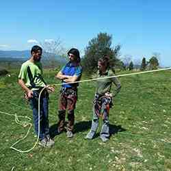
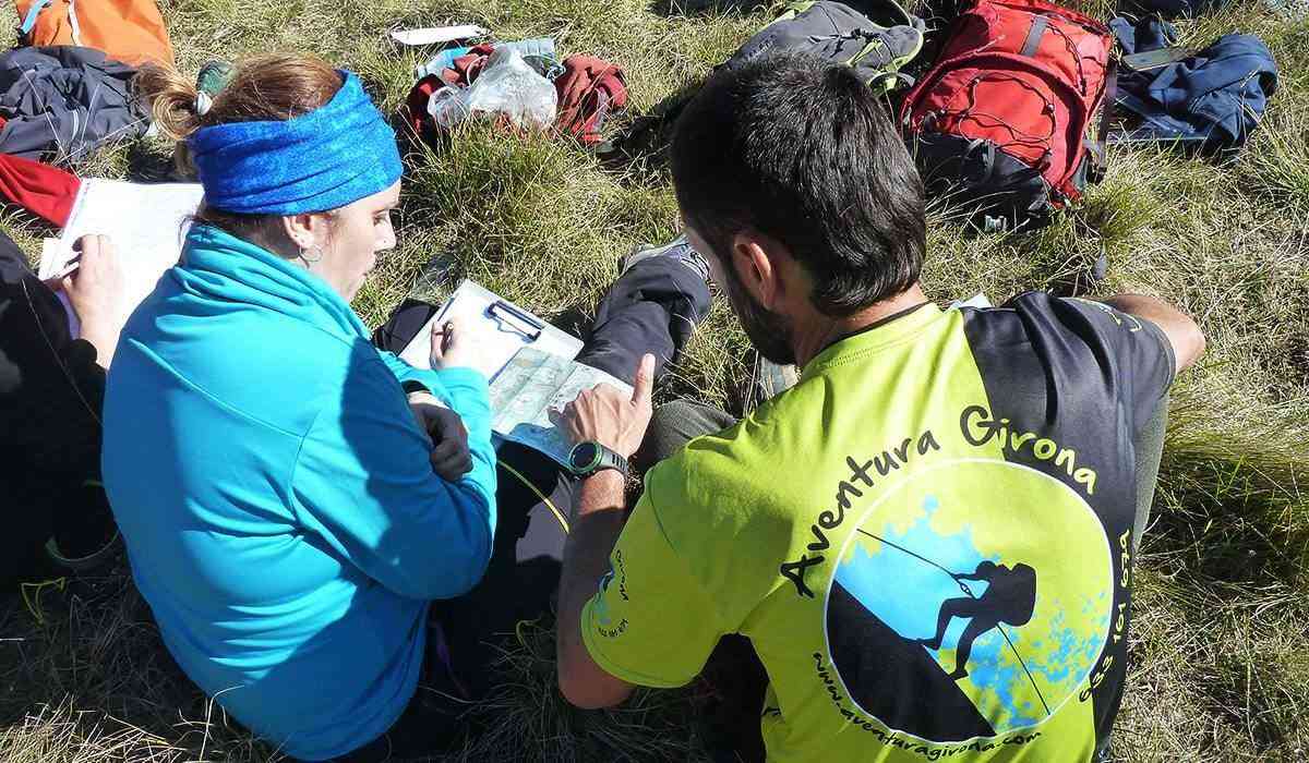
Our Orientation Course, designed for those mountaineers who seek to know at all times where they are located and want to start excursions with guarantees of success without neglecting safety at any time. With good weather and knowledge of the terrain, it is easy to find your way around, but what happens when the weather is not good and we go through an unknown terrain?
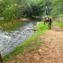
The course will take place in Sadernes (Alta Garrotxa), taking advantage of the terrain and the beauty of the environment.
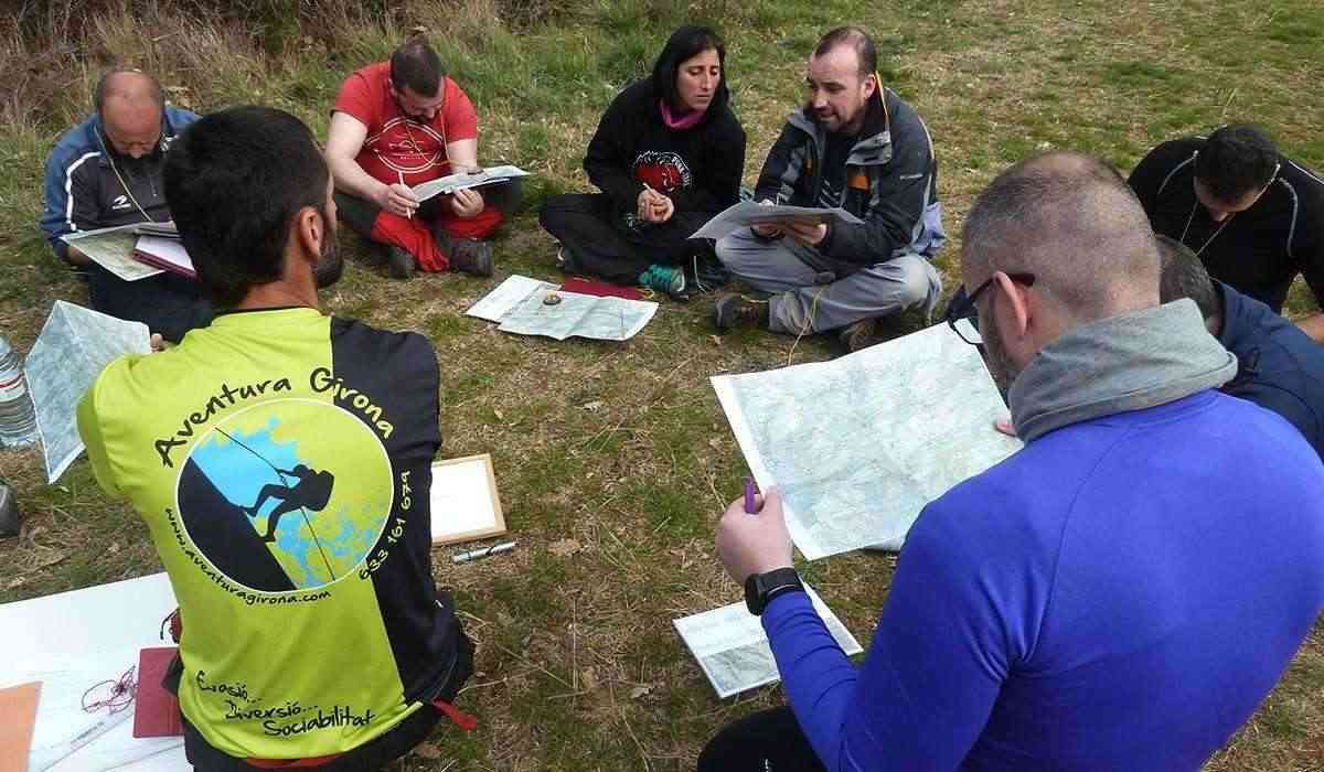
The course organization is divided into theoretical and practical classes.
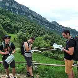
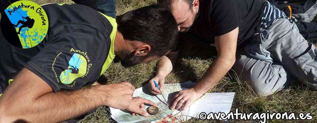
First thing in the morning, there will be a theoretical session on basic notions of cartography.
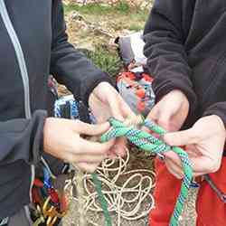
Description and use of the compass. Together we will design a route, calculating unevenness, distance, and estimated time to complete it. When we do the route, all the assimilated concepts will be put into practice in the morning. We will carry out triangulations with the compass, we will use the altimeter and GPS. The intention is that we know at all times where we are located on the map.
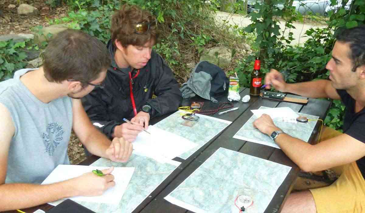
The route that we will take will be recorded with the GPS, or any app that the participant has previously installed on the mobile. According to our convenience we will create waypoints of our own interest.
At the end of the route we will contrast the initial route created on the map with the route recorded with the GPS or location tracking app ……
Participants are advised to have any of the following App downloaded to their mobile: Wikiloc, Strava, Peak Finder ... and others.
The objectives of the course are the following:
- Adapt the different forms of progression
- Become aware of the importance of respect for the environment
- Recognize risks and ensure safe practice
- Correctly use the necessary individual equipment
- Know and practice basic safety maneuvers
- Interpret distress signals
- Plan the accesses, exits and evacuation places according to the difficulties and capacities of the people in a group or rescue.
- Apply the most suitable fortune techniques to solve unforeseen situations
The course contents are as follows:
- Basic notions of cartography: geographical elements, projections, coordinates, concept of magnetic declination, types of maps.
- Topographic maps: Parts of a map, relief, contour lines, terrain morphology, distances, slope, symbols.
- Orientation with natural means: the sun, the moon, the stars, the vegetation and other signs, reading the map. Situate.
- Orientation with artificial means: The compass, the altimeter, the GPS.
- The compass: Description. Parts of a compass, protocol of use, declination, heading.
- Orientation with map and compass: Orient the map, azimuth, direction between two points, protocol to identify points on the ground on the map, protocol to locate points on the map on the ground, triangulations.
- Orientation techniques and tactics: Map tracking, dead reckoning, accurate orientation, poor visibility navigation.
- Create an itinerary: Choosing the route, drawing the itinerary, calculating time, calculating slopes, calculating distances, itinerary file, itinerary profile.
SEASON: This activity takes place throughout the year with exception the months of July and August.
DIFFICULTY: Beginner.
ADVENTURERS: From 12 years of age up.
MEETING POINT: Gas station Montagut on A26 exit 75 - View Map
MEETING TIME: 9:00
PARKING: 15 minutes from the meeting point. Participants will follow the guide car in theirs.
DURATION: All day. 9:00 to 17:00, stopping 30 minutes to eat.
EQUIPMENT: Mountain clothing according to the time of year, sneakers / mountain boots, backpack, Food and drink for the day, sunscreen, if you want sunglasses. Wikiloc and strava app downloaded to mobile. If you wish, you can also bring a map and hiking guide of Alta Garrotxa, alpine publishing house, scale 1: 25000, compass, altimeter and GPS.
GROUPS: For a good training the courses will not exceed 6 people per guide.
Training Orientation Girona Catalonia Prices
1 person: 180 euros
Group of 2: 90 euros per person
Group of 3-6 people: 65 euros per person
You can join existing groups created by Adventure Girona.
What is included in the price: Qualified guide, photographic report and civil liability and accident insurance Technical advice during and after the course. Didactic material (colour photocopy of the 1: 25000 scale alpine map of Alta Garrotxa of the area where the training is carried out. Compass and notes from the course).
All the multi-activities that Adventure Girona offers are covered by an accident insurance as well as by the civil liability scheme, as required by the regulations in force that regulate Physical Sports Activities in the Natural Environment (Decree 56/2003).
Complete information on the coverage and conditions of the insurance is available to clients at our offices.
Customers can request, if required, complaint forms from the company.
Other Activities you should try: